Mancos Marshal orders evacuation of blocks by the river
Montezuma County posted the order late Sunday night as the Mancos River rose toward its forecast crest. The county named a shelter at 301 Grand Ave. and has posted nothing since to say the order has been lifted.
Montezuma County posted an evacuation order for part of Mancos at 11:06 p.m. on Sunday, saying the Mancos Marshal was ordering people out of several blocks beside the rising Mancos River.
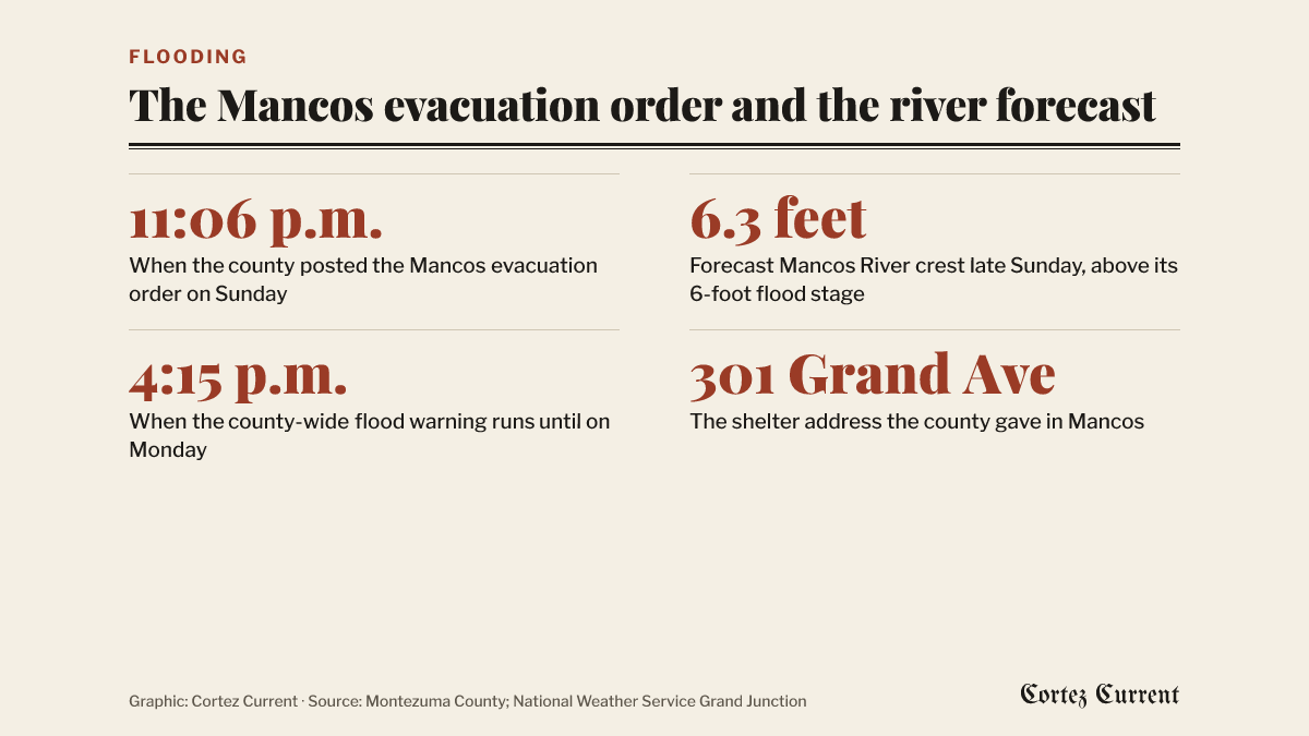 Graphic: Cortez Current. Source: Montezuma County; National Weather Service Grand Junction
The county’s notice, posted on its Facebook page, reads in full:
MANCOS - EVACUATION ORDER. Mancos Marshal issuing EVACUATION ORDER inside the area boundaries of 1st to Mesa to 2nd St to Walnut back to 1st ST.
This is due to the Mancos River rising based on water runoff due to excessive rain. Predictions of river rising will cause flooding in this area.
Shelter is located at Mancos Elementary High School, 301 Grand Ave, Mancos, CO.
That is the whole of what the county said. It did not give a number of homes, a number of people or an expected duration, and it did not say when the order would be reviewed.
What the river was forecast to do
The weather service’s flood warning for the Mancos River near Mancos went out at 10:50 a.m. on Sunday and runs until 7 p.m. on Monday. It forecasts minor flooding.
The gauge read 4.8 feet at 10 a.m. on Sunday. Bankfull is 5 feet and flood stage is 6 feet. The bulletin expected the river to rise above flood stage during Sunday evening, crest at 6.3 feet late in the evening, and fall back below flood stage late in the night. At 6 feet, it says, minor flooding can be expected around Mancos. A 6.3-foot crest would be the highest the gauge has recorded since 5.7 feet on May 21, 2005.
The county’s order was posted at 11:06 p.m., which is inside the window in which the bulletin expected the river to be at or near its crest.
Whether the order is still on
The Current cannot say. The county has posted nothing on its Facebook page since the 11:06 p.m. order, and the page’s own feed would show only its newest post when the Current read it on Monday morning. The county’s website carries no post about the flooding at all; its most recent item is dated Oct. 28. Nothing the Current can read says the order has been lifted, and nothing says it is still in force.
Anyone in or near the area the order names should treat the Mancos Marshal’s Office and Montezuma County emergency management as the authority on it rather than this story.
The wider warning
A separate flood warning covers Montezuma County in full until 4:15 p.m. on Monday. It describes major flooding caused by excessive rainfall, calls the situation across southwest Colorado and southeast Utah “significant and historic,” and carries the phrase “This is a PARTICULARLY DANGEROUS SITUATION,” in the weather service’s own capital letters. Its impacts line says flooding of rivers, creeks, streams and low-lying ground is occurring and that “numerous roads remain closed due to flooding.”
A flood watch for the wider forecast area was still due to run until 11 a.m. Monday, and a winter storm warning for the San Juan Mountains above 10,000 feet until noon Monday.
Montezuma County emergency management listed seven county roads closed and six more with water or debris across them through Sunday afternoon. It has not published an updated list. The state highways are at cotrip.org, which is the Colorado Department of Transportation’s own record of what is open.
Tuesday is Election Day. The county’s voting centers and ballot drop boxes are listed in the Current’s voter guide, and the county has said nothing about the weather affecting them.
Reporting a problem
For an emergency, call 911. In its Sunday afternoon alert the county asked people who see major flooding to call dispatch at 970-565-8454, and the Road and Bridge Department gave 970-565-8441 for reporting damage. Both numbers are the county’s own.
The weather service’s advice with every one of these products is the same: “Turn around, don’t drown when encountering flooded roads. Most flood deaths occur in vehicles.”
The warnings are on the weather service’s active alerts page, and the Grand Junction office’s forecast is at weather.gov/gjt. Any active watch or warning also shows by itself on the alert bar at the top of every page on this site.