San Juan River flood warning runs through Thursday
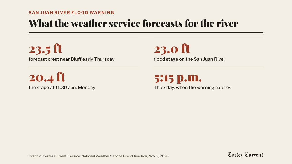
The weather service expects the river to crest near 23.5 feet early Thursday at Bluff, Utah, and says flood water from Sunday's rain should reach the Four Corners on Wednesday evening. The warning covers Montezuma County and southern San Juan County, Utah.
The National Weather Service issued a new flood warning for the San Juan River at 12:31 p.m. on Monday, and it runs until 5:15 p.m. on Thursday. The office in Grand Junction says flooding along the river caused by excessive rainfall is expected, and that the water now working its way down from Sunday’s storms should reach the Four Corners on Wednesday evening.
 Graphic: Cortez Current. Source: National Weather Service Grand Junction
The warning is listed for Montezuma County in Colorado and San Juan County in Utah. Under WHERE, the bulletin puts it “along the San Juan River from the Four Corners through Mexican Hat, UT,” and adds: “This includes Bluff, Montezuma Creek and Aneth.” All three of those named places are in Utah; the Colorado end of the warned stretch is the Four Corners itself, in the far southwestern corner of Montezuma County.
What the river is forecast to do
The weather service gives the gauge readings in full. The stage was 20.4 feet at 11:30 a.m. on Monday. Bankfull is 22 feet and flood stage is 23 feet. The bulletin says the river will rise to 22 feet late Monday evening, with “a secondary crest near 23.5 feet expected near Bluff early Thursday morning,” then fall below flood stage later Thursday morning.
Its impacts paragraph says river levels are still rising on runoff from Sunday’s rainfall and that forecasters expect “high water levels and the River exceeding its banks, inundating low-lying areas along the San Juan River.” It calls this “a prolonged period of high water” and notes it will take several hours for all the water from the storms to work through local drainage systems.
Under additional details the bulletin says that at 12:22 p.m. on Monday there were stream gauge reports upstream and that impacts of flooding had been reported along the San Juan River near Farmington, New Mexico. It expects the flood water to reach the Four Corners on Wednesday evening and the town of Bluff early Thursday morning, and says the timing of the crest “is subject to change as more details become available.”
The places the bulletin lists as ones that will experience flooding are Mexican Hat, Bluff, Montezuma Creek and Aneth.
Warning, watch, advisory
The weather service uses three levels, and they are not interchangeable. A watch means flooding is possible. A warning, like this one, means flooding is happening or about to happen. An advisory covers conditions that are a nuisance or a hazard but short of a warning.
The other river
A separate flood warning, for the Mancos River near Mancos, was issued on Sunday morning and expires at 7 p.m. on Monday. It forecast minor flooding and a crest of 6.3 feet late Sunday evening, above the river’s 6-foot flood stage. Montezuma County posted an evacuation order for several blocks of Mancos beside that river at 11:06 p.m. on Sunday and has not said since whether it has been lifted.
Cortez collection sites have been gathering supplies for people flooded out along the San Juan River since late October, after an earlier round of flooding on the same river.
What the bulletin advises
The weather service’s own instruction is: “Turn around, don’t drown when encountering flooded roads. Most flood deaths occur in vehicles.” It adds that people should be especially cautious at night, when the dangers of flooding are harder to recognize, and should not drive on flooded roads.
State highway conditions are at cotrip.org, the Colorado Department of Transportation’s own record of what is open. The full text of this warning and any others is on the weather service’s active alerts page, and the Grand Junction forecast is at weather.gov/gjt. Any active watch or warning also shows by itself on the alert bar at the top of every page on this site.