Flood warnings cover Mancos, Mesa Verde and Dolores
The weather service issued four flood bulletins for Montezuma County between Thursday night and early Friday. Low-water crossings may not be passable, and the wider flood watch now runs to midnight Friday.
Rain that had already damaged two county roads kept falling overnight, and the National Weather Service put most of Montezuma County under flood bulletins between Thursday evening and dawn Friday. One of them covers Mancos and Mesa Verde National Park until noon.
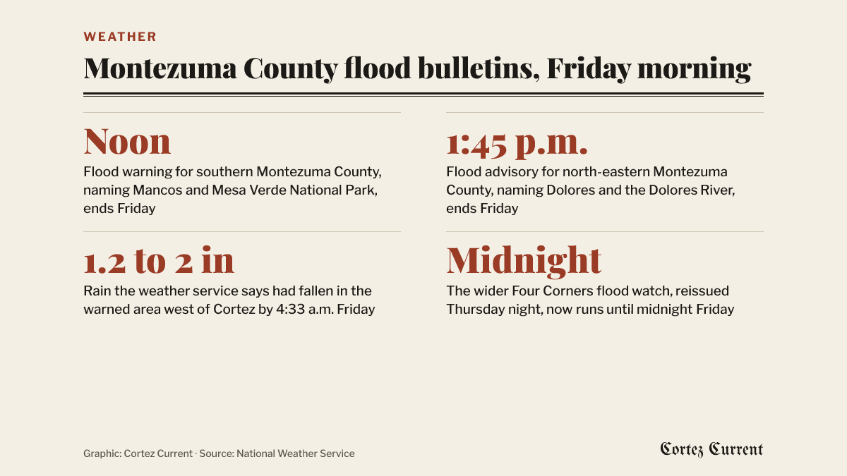 Graphic: Cortez Current. Source: National Weather Service
The bulletins, all from the weather service’s Grand Junction office, cover different corners of the county and end at different times.
Southern Montezuma County, until noon Friday
A flood warning issued at 12:01 a.m. Friday covers southern Montezuma County until noon. Forecasters named Mancos and Mesa Verde National Park as places that will see flooding, and listed nine waterways: the East, West and Middle Mancos rivers, the Mancos River itself, Ute Canyon, West Fork Mud Creek, Lewis Creek, Lost Canyon Creek and East Canyon.
“Low-water crossings are inundated with water and may not be passable,” the bulletin says. Doppler radar and stream gauges showed heavy rain at 12:01 a.m., and the warning says flooding of rivers, creeks and other low-lying ground is “imminent or occurring” as streams keep rising on runoff from earlier rain.
Dolores, until 1:45 p.m. Friday
A flood advisory issued at 1:51 a.m. covers north-eastern Montezuma County until 1:45 p.m. Friday. It names Dolores, and the Dolores River and Lost Canyon Creek. Gauges showed heavy rain from thunderstorms at 1:50 a.m. The weather service expects minor flooding in low-lying ground and places that drain poorly.
An advisory is a step below a warning: it means flooding is expected but is not the threat to life and property a warning describes.
West of Cortez, and across the Utah line
Two more flood warnings cover the county’s western edge and run into southeastern Utah.
The first, issued at 9:39 p.m. Thursday, runs until 9:45 a.m. Friday and covers western Montezuma County and southern San Juan County, Utah. It names Toh Dahstini Wash, Tohache Wash, Cowboy Wash and the San Juan River, and says rivers and streams would keep rising through the night and are expected to peak Friday afternoon. Mexican Hat, Bluff, Halchita, Tselakai Dezza, Montezuma Creek and Aneth are inside it.
The second was reissued at 4:33 a.m. Friday for west central Montezuma County and southeastern San Juan County, Utah, running until 6:45 a.m. It names Cortez and Aneth, and says between 1.2 and 2 inches of rain had fallen.
The watch now runs a day longer
The wider Four Corners flood watch, which took effect Wednesday, was reissued at 9:50 p.m. Thursday and now runs until midnight Friday. It had been set to end at noon. The watch covers the Four Corners and Upper Dolores River, the Animas and San Juan river basins, the southwest and northwestern San Juan Mountains, the Uncompahgre Plateau, the Paradox Valley and parts of southeast Utah.
Montezuma County passed the extension on to residents at 9:56 p.m. Thursday, posting on its Facebook page that the flood warning had been extended and that the watch was in effect into Saturday.
The weather service’s advice in every one of Friday’s bulletins is the same: do not drive through water lying across a road. “Most flood deaths occur in vehicles,” they say, and forecasters ask people to report flooding to local emergency services or law enforcement when it is safe to do so.
What it has already done
Rockfall on Road G and sinkholes on Road J have had county crews out since Tuesday; that running account is in our report on the two roads. Thursday afternoon’s flood warning for McElmo Creek and the severe thunderstorm watch that went with it have both expired.
Empire Electric’s outage map showed no active outages at 6:20 a.m. Friday.
Current watches and warnings for the Cortez area are listed by the National Weather Service.