Flood warning for McElmo Creek as storm watch covers Cortez
The weather service warned of small stream flooding west of Cortez on Thursday afternoon and put the county under a severe thunderstorm watch until 9 p.m. One to two inches of rain has fallen in 24 hours.
The National Weather Service issued a flood warning for part of Montezuma County on Thursday afternoon and placed the county under a severe thunderstorm watch until 9 p.m., as two days of rain began to tell on creeks and county roads.
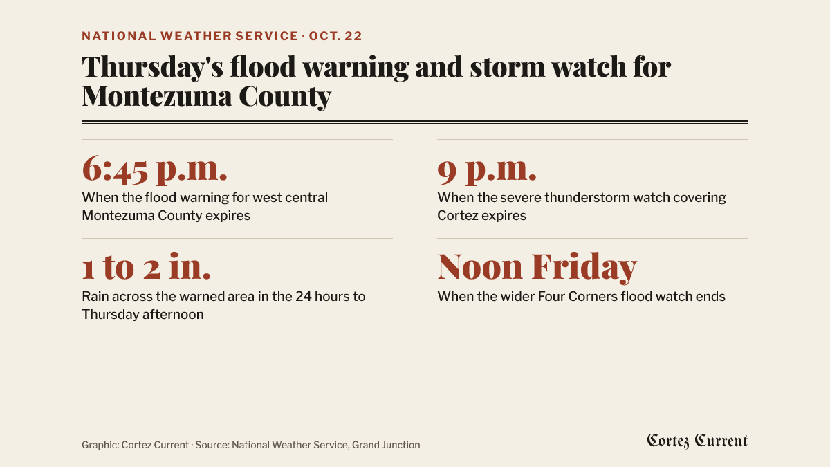 Graphic: Cortez Current. Source: National Weather Service
The flood warning, issued at 3:45 p.m. by the weather service’s Grand Junction office, runs until 6:45 p.m. and covers west central Montezuma County and southeastern San Juan County, Utah. The bulletin says small stream flooding caused by excessive rainfall is expected, and that flooding of rivers, creeks, streams and other low-lying ground is “imminent or occurring” as streams keep rising on runoff from earlier rain.
The one place the warning names is low-lying ground along McElmo Creek between Cortez and Aneth.
Forecasters said Doppler radar and automated gauges showed heavy rain at 3:42 p.m., and that between one and two inches of rain had fallen across the warned area in the previous 24 hours.
The weather service’s advice is to turn around rather than drive through water across a road. “Most flood deaths occur in vehicles,” the bulletin says.
A severe thunderstorm watch until 9 p.m.
Separately, the weather service issued severe thunderstorm watch 695 at 3:05 p.m., in effect until 9 p.m. It covers six Colorado counties — Archuleta, Dolores, La Plata, Montezuma, San Juan and San Miguel — and San Juan County in Utah. Cortez, Dove Creek, Rico, Durango, Telluride, Silverton, Pagosa Springs and Bayfield are among the towns inside it.
A watch means conditions are favourable for severe storms, not that one has been spotted; a warning means severe weather is happening or about to. Montezuma County posted its own note at 3:52 p.m. saying scattered severe storms were possible through the day, with large hail and heavy rain the main threats.
What it has done to the roads so far
Two county roads north-west of Cortez are already damaged, and the county said at 5 p.m. Thursday that it expects worse. That notice, and the one it updates, are in our running report on Road G and Road J.
The broader flood watch the weather service issued on Tuesday is still running. It was reissued at 1:49 p.m. Thursday and now lasts until noon Friday, covering the Four Corners and Upper Dolores River, the Animas and San Juan river basins, the southwest San Juan Mountains and parts of southeast Utah.
Empire Electric’s outage map showed no active outages at 5:13 p.m.
Current watches and warnings for the Cortez area are listed by the National Weather Service.