Winter advisory puts 4 to 8 inches on the San Juans
The weather service has issued a winter weather advisory for the Southwest San Juan Mountains above 9,000 feet from midnight tonight to 9 p.m. Saturday. The advisory does not cover the Montezuma Valley, where no watch, warning or advisory is in effect.
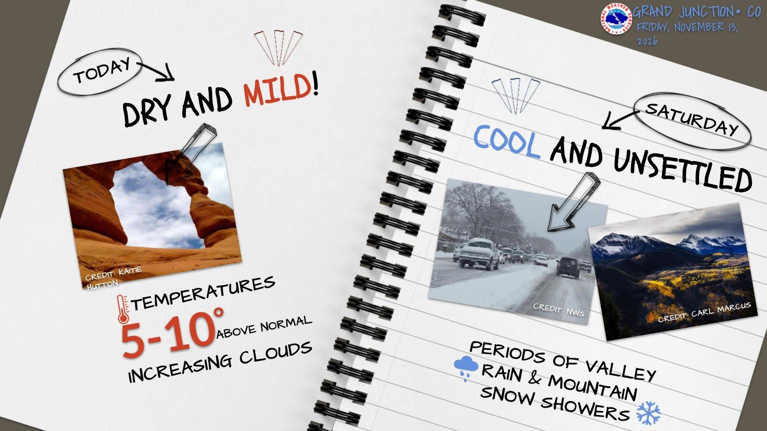
The first real winter weather of the season is due in the high country above Montezuma County overnight.
The National Weather Service’s Grand Junction office issued a winter weather advisory at 8:40 a.m. on Friday for the Southwest San Juan Mountains, running from midnight tonight to 9 p.m. on Saturday, November 14.
The bulletin is short. “Snow expected above 9000 feet,” it says. “Total snow accumulations between 4 and 8 inches with locally higher amounts possible.” Under impacts, one line: “Travel could be very difficult.”
The weather service’s advice is to slow down and use caution while traveling, and to call 511 for the latest road conditions.
It is the mountains, not the valley
The named area is the Southwest San Juan Mountains — zone COZ019 — and the snow level in the bulletin is 9,000 feet. The Montezuma Valley, which is its own forecast zone, has no watch, warning or advisory in effect, and neither does anywhere else in the county below that line.
For drivers out of Montezuma County, the advisory is the one to read before heading up CO 145 toward Lizard Head Pass or over the high ground east of Mancos and Dolores on Saturday.
An advisory is the lowest of the weather service’s three levels. A watch means conditions are possible; a warning means they are happening or about to; an advisory means the weather is expected and will be an inconvenience or a hazard, but short of warning criteria.
What the forecast office has been saying
In a post early Friday morning, the Grand Junction office described “a disturbance set to bring valley rain and mountain snow to the region tonight through Saturday evening,” and said the San Juans “are favored for 6 inches or more of snowfall.” Its graphic for the day gives Friday as dry and mild, 5 to 10 degrees above normal, and Saturday as cool and unsettled, with periods of valley rain and mountain snow showers.
That tracks the briefing the Town of Mancos passed on to residents on Thursday afternoon, which the weather service had issued at 2 p.m. on Wednesday. It called for unseasonably warm, dry weather through Friday, a system moving in on Saturday with valley rain and mountain snow above 8,000 to 9,000 feet, and the possibility of more precipitation on the evening of Tuesday, November 17 or on Wednesday, November 18 — with, the weather service said, very low confidence in next week’s precipitation.
The town asked residents to stay aware of changing conditions as the community continues to recover from the flooding at the start of the month.
Source: National Weather Service, Grand Junction, Colorado — winter weather advisory for zone COZ019, issued November 13, 2026 at 8:40 a.m. MST, read through api.weather.gov; and the office’s own forecast post and graphic of November 13, 2026. Active alerts for zones COZ021, COC083 and COZ019 were read on Friday evening.